Culebra snorkeling map: how the island and its reefs fit together
Four numbered roads, one town and one ferry dock explain almost every snorkel entry on Culebra. Start at the terminal in Dewey and work outward to the sheltered southwest bays, the windward beaches and the cays you can only reach by boat.
Updated 10 October 2026
In shortOn a Culebra snorkeling map everything radiates from the ferry terminal on Calle Pedro Márquez in Dewey. PR-250 runs 9.0 km (5.6 mi) east to Zoni, PR-251 covers 2.9 km (1.8 mi) north to Flamenco, PR-252 heads northwest toward Melones and PR-253 drops south to Punta Soldado. The calm reefs sit on the southwest coast, Carlos Rosario is walk-in only, and Culebrita and Cayo Luis Peña need a boat.
5.6 miPR-250, pier to Zoni
1.8 miPR-251 to Flamenco
6 AM–6 PMrefuge land and trails
21 caysinside the refuge
Main snorkeling beachSnorkel spot or offshore cayTown and ferry arrivalVisitor information
The sheltered southwest coast between Flamenco and Punta de Vapor holds Culebra's calm-water snorkel beaches, with the refuge cays lying just offshore.
How to read a Culebra snorkeling map from the ferry dock
Zero point on this map is the Culebra terminal on Calle Pedro Márquez, in Dewey, the only town on the island, reached from the Ceiba terminal at Marina Dr., Roosevelt Roads on a crossing the operator puts at about 1 hour 30 minutes. Walk out of the gate and you are already at the western end of PR-250, which starts at the Port of Culebra pier and runs about 9.0 km (5.6 mi) east until it dead-ends at Zoni Beach. Every other road on the island branches off it.
Hold the Culebra island layout in your head as four spokes. PR-251 leaves PR-250 in front of Benjamín Rivera Noriega Airport, a junction roughly 1.3 km (0.81 mi) from PR-250's western terminus, and covers 2.9 km (1.8 mi) northwest to Flamenco, giving indirect access to Tamarindo and Punta Molinos on the way. PR-252 runs 1.5 km (0.93 mi) northwest from the pier and ends where the municipal roads to Quintas de Culebra and Melones Beach begin. PR-253 leaves PR-250 at the drawbridge over the Ensenada canal and runs about 2.8 km (1.7 mi) south past Playa Sardinas II to Calle Punta Soldado.
Reef position follows the same geography. The sheltered water is all on the southwest, where the Canal de Luis Peña Natural Reserve lies between the Flamenco Oeste peninsula and Punta de Vapor, with the 342-acre refuge cay of Cayo Luis Peña sitting offshore of it. The north and east beaches face the open channel, which is why Zoni, Resaca and Brava read beautifully on a map and rarely snorkel well.
Beach or cay
Where it sits
How you reach it
Lifeguards
Melones
Southwest, inside the reserve
PR-252 from the pier, then the municipal road; within walking distance of Dewey
None
Tamarindo
Southwest, inside the reserve
Off PR-251
None
Carlos Rosario
Southwest, inside the reserve
Trail only, from the back left corner of the Flamenco lot; otherwise boat, kayak or water taxi
None
Flamenco
North-facing horseshoe, about 2.5 miles from Dewey
PR-251 to its dead end
Yes, the one beach on this list that has them
Playa Resaca
North coast
End of the road just east of the airport off PR-250, then a strenuous hike through mangrove and boulders
None
Playa Brava
North coast
East on PR-250, left after the cemetery, then downhill on foot; may be closed April to June for turtle nesting
None
Zoni
Far east, exposed
The dead end of PR-250
None
Punta Soldado
South of Dewey
PR-253 from the drawbridge, then Calle Punta Soldado at the end of Calle Fulladoza
None
Cayo Luis Peña
Refuge cay off the leeward coast, about 342 acres
Boat, kayak or water taxi
None
Culebrita
About 5 miles offshore to the east
Boat only
None
The sheltered southwest coast and its shore entries
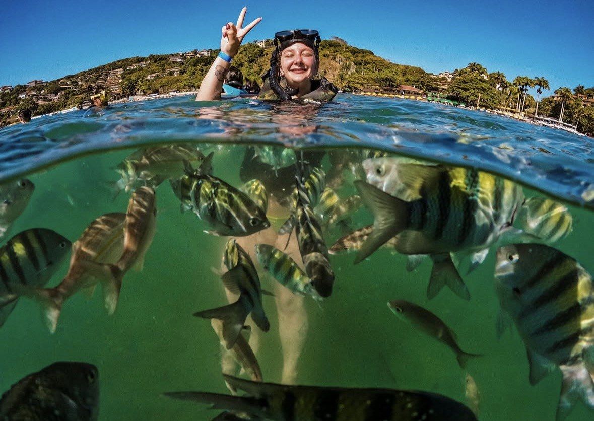
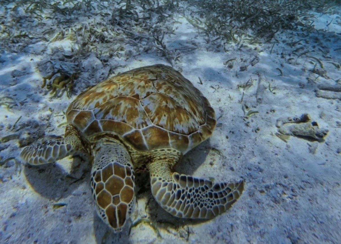
Melones is the closest snorkel water to the dock. Follow PR-252 northwest to the point where the municipal roads to Quintas de Culebra and Melones split off, and the beach is within walking distance of Dewey: rocky, backed by subtropical forest, with protected seagrass offshore where green turtles feed. Swim over that grass rather than standing in it; the island's seagrass beds carry a designated critical habitat status, and both standing on them and dragging fins through them are prohibited.
Tamarindo is the next entry north, a turn off PR-251 before the road climbs on to Flamenco. Soft corals and sea anemones are what it is known for, with Cayo Luis Peña taking the swell out at sea. Nothing may be removed anywhere in here: the Canal de Luis Peña Natural Reserve, designated on 11 June 1999 after an 18-year local campaign and covering roughly 4.8 square kilometres (1,208 acres), was the first no-take marine protected area in Puerto Rico, and DNER banned fishing inside the channel the same year.
South of town the map keeps going. PR-253 leaves PR-250 at the drawbridge, passes Playa Sardinas II and ends at Calle Punta Soldado, the access road for Punta del Soldado, which local sources recommend for snorkeling as well as diving. None of these southwest beaches has lifeguards, so treat the leeward coast as a morning proposition when the water is at its flattest and you can see what you are swimming over. Reef contact is the thing to avoid: the lightest touch of a hand, foot or fin damages coral.
Flamenco, Zoni and the exposed north and east beaches
PR-251 ends at Flamenco, about 2.5 miles from Dewey on a hilly route. On the map it reads as a mile-long horseshoe, and it is the one entry on the island with infrastructure behind the sand: restrooms, changing rooms, showers, picnic tables, chair and umbrella rentals, camping, a large parking lot, food kiosks, plus the lifeguards that no other Culebra snorkel beach has. Hours vary by facility, so check the clock against what you need: parking from 7:30 AM until sunset, restrooms and showers 7 AM to 6 PM, kiosks roughly 8 AM to 5 or 6 PM, and one local source puts the gate at 7am to 5:30pm, which is the number to trust when planning the drive back out. Admission and parking are charged by ACDEC, the municipal Autoridad de Conservación y Desarrollo de Culebra, at amounts published back in October 2018, so ask at the entrance.
Snorkeling at Flamenco is confined to one corner. The reef lies at the east end, known locally as the Shark Cages, and entry and exit is through the gap between the two rows of concrete and rock rather than over the reef itself. At the opposite end of the sand, past the main beach area, the two Sherman practice tanks sit on the west side, one graffitied and one rusting, with a short rocky trail where beach shoes help. The map stops at the headland: the Flamenco peninsula and the cays beside it are off limits to the public, which keeps the sooty tern colonies nesting there undisturbed.
Zoni finishes PR-250 on the far east side, usually deserted, with Culebrita, Cayo Norte and St Thomas in view across open water. Resaca is reached by driving to the end of the road just east of the airport and then hiking through mangrove and boulders, and the reef there makes swimming difficult. Brava is a left after the cemetery and a walk downhill, with possible closures from April to June for sea turtle nesting. Go for the walk and the view, and save your mask for the leeward side.
The beach you can only walk to
Carlos Rosario has no road. The path leaves from the back left corner of the Flamenco parking lot and crosses an exposed hill, just under a mile, 20 to 30 minutes depending on how often you stop, and walkers should carry on past the first small beach they come to. Dive crews rate the reef here among the island's best, a long healthy stretch with large sea fans, which is why the walk gets made.
Walk it in the morning and build the day around it. The beach at the far end has no facilities of any kind, and currents can be strong in places, so water, food and anything else you want is carried over the hill and back again. The trailhead carries a refuge notice about unexploded ordnance from the Navy-era bombing ranges and states that use is at your own risk, and there are rocks and thorns along the way. Land inside the refuge, trails included, is open to the public daily from 6:00 AM to 6:00 PM, which fixes the latest sensible start.
Boat, kayak and water taxi are the alternatives, and they all arrive on the same sand without the hill. If the walk is in doubt, take one of those instead.
Boat-only entries on a Culebra snorkeling locations map
Three parts of the map have no shoreline access at all. Isla Culebrita sits about 5 miles off Culebra with a hull as the only way in; there is nothing on it in the way of facilities, no lifeguards either, and its 19th-century Spanish-era lighthouse is shut to the public because of the state the structure is in. Cayo Luis Peña, the 342-acre refuge cay that calms the Tamarindo and Carlos Rosario side, is boat, kayak or water taxi only. The cays scattered beyond that are part of the same federal holding: 1,510 acres of refuge land taking in 21 offshore cays, so most of the water worth snorkeling is ringed by protected ground.
Boats work to a different rule book than swimmers. Vessels visiting Culebra's reefs are asked to tie to mooring buoys instead of dropping anchor, and to slow down near shore and in the shallows, which is one practical reason a captain who runs these reefs daily picks the stop rather than you. NOAA's viewing guidance covers the swimmer's side of it: hold at least 50 yards off any sea turtle, and touching, riding or petting one is out.
A boat day is also the only way to string several reefs into one itinerary. Shore snorkeling gives you one bay at a time; a six or seven hour trip links the leeward reef, a cay and open water on the same tank of fuel.
Several reefs in one 6-hour day
Six hours from $168 on the all-inclusive beach and snorkel day, rated 4.7 from 1083 reviews, with gear, drinks and a light lunch included and an 8:00am meeting that gets you on the water before the wind reaches the map's sheltered side.
For a day on land, build it in this order. Be in the water on the southwest side before 10 AM, because the trade winds build through the day and only the southwest-facing coves stay sheltered. Melones first if you are on foot from Dewey, Tamarindo if you have a golf cart and want the soft corals, then Flamenco for lunch, shade under the pines by the picnic tables and the one snorkel at the east end. Carlos Rosario replaces all of that on a calm morning, with the refuge's 6:00 AM opening as the earliest legal start on the trail.
For a day on the water, book the boat and let someone else solve the wind. Six hours from $168 covers the Culebra Snorkeling and Beach Day Tour All Inclusive, which holds a 4.7 rating across 1083 reviews. Price takes in snorkel gear, non-alcoholic drinks, rum drinks and a light lunch of cold-cut sandwiches, fresh fruit, chips and dips, and the 8:00am meeting at the gray gazebo with the orange roof in front of the parking lot puts you over the reef while the leeward coast is still flat. Gratuities are not included.
Staying near Fajardo changes the answer. The Culebra Snorkeling Tour by Catamaran from Fajardo is 6 hours from $180, rated 4.6 from 2722 reviews, the highest review count on this site, with lunch, sodas, juices, water, local beer and snorkel gear included; drivers check in at Puerto del Rey Marina 45 minutes before departure, where there is parking near the boat departure area, and hotel pickup is not part of it. On both tours, a cancellation made 24 hours or more ahead of the scheduled departure time is refunded in full.
Island logistics to have in hand before you choose: a rental car cannot cross on the public ferry, since vehicles load only for Vieques and Culebra residents, so drivers park at Ceiba for about $15 per day with a continuous shuttle to the gate. On Culebra itself, PR-250, PR-251, PR-252 and PR-253 cover the ground, públicos and taxis run, and shared taxis from the ferry dock to Flamenco cost about $5 per person each way, since the road has no sidewalks to walk.
Morning, no vehicle: PR-252 to Melones, back for lunch in Dewey
Morning, with a cart: PR-251 to Tamarindo, then on to Flamenco's east end
Calm morning, on foot: the Flamenco lot to Carlos Rosario and back before the wind
Several reefs in one day: a 6-hour boat trip, from $168 or from $180
Far east on PR-250: Zoni for the view across to Culebrita, Cayo Norte and St Thomas
Questions people ask
Can I bring a rental car over on the ferry to drive between the beaches?
No. The ferry takes a vehicle aboard only when its owner is a resident of Vieques or Culebra, and the port windows are the sole place vehicle tickets are sold. Drivers leave the car in the Ceiba terminal lot, about $15 per day with a shuttle running continuously to the gate, and arrange a jeep or golf cart once on the island. Carlos Jeep Rental keeps a main office on Carr. #250 and an airport office on PR-251, takes bookings on (787) 742-3514, and is open seven days a week.
How far is Culebra's airport from the dock and the beach roads?
PR-250 meets PR-251 in front of Benjamín Rivera Noriega Airport, roughly 1.3 km (0.81 mi) from PR-250's western terminus at the ferry pier, so the airstrip is under a mile from town. From that junction it is 2.9 km (1.8 mi) up PR-251 to Flamenco. Three carriers land at CPX, Air Flamenco, Cape Air and Vieques Air Link, all onto one 2,600 ft runway, and most of the hops take under 25 minutes.
Which places on the map have no facilities?
Carlos Rosario has nothing on site, and currents can be strong in places, so water, food and shade all go in and out with you. Culebrita has no facilities and no lifeguards, and the cays have no stores at all, which is why the water-taxi operators tell you to bring water, sunscreen, snacks, a towel and a hat. Flamenco is the exception, with restrooms, changing rooms, showers, picnic tables and food kiosks.
Do I need my own snorkel gear for the shore beaches?
Boat days listed here supply masks, fins and snorkels, so gear is only a shore-day question. The shop opposite the ferry terminal rents a mask, snorkel and fin set for $20 per day, $25 with a vest, dropping to $16 per day once you keep it five days or more, with no reservation required and hours of Monday to Saturday, 9 AM to 4 PM. Pack your own mask if you know it seals.
Where is the refuge office if I want to ask about access on the ground?
Culebra National Wildlife Refuge keeps its office on Carr. 250 at Km 3.5, Culebra PR 00775, with a phone line on 305-394-2028 and an email address for enquiries. Interpretive visits for groups and school parties are arranged on request. Refuge public areas and hiking trails, the route to Carlos Rosario included, are open daily from 6:00 AM to 6:00 PM.
Based near Fajardo, the catamaran day runs 6 hours from $180 with lunch, drinks and snorkel gear, rated 4.6 from 2722 reviews, meeting at Puerto del Rey Marina 45 minutes before departure. A full refund applies when the cancellation lands 24 hours or more before the scheduled departure time.